Your Cart is Empty

A Perfect Hike In Black Moshannon, PA: Moss-Hanne Trail
Moss-Hanne Trail, Black Moshannon State Park
Distance: 8.0 miles with additional options.
Access: There are multiple trailheads along this 8-mile trail. We like to start at the parking area adjacent to Black Moshannon Lake at Mooring Area 3, near the southern end of West Side Road, and hike to the parking area at the intersection of Shirks and Beaver Road at the southern boundary of Black Moshannon State Park. This requires a car shuttle. Another option is to make a longer loop around the lake using Star Mill Trail and the park roads. The full loop around the lake is closer to a 12-mile hike.
Black Moshannon State Park is 3,394 acres of forests and wetlands within the more than 43,000 acres of the Moshannon State Forest. The Moss-Hanne Trail is a year-round favorite that is open to hikers and cross-country skiers, but summer is the perfect time to try it for the first time! The linear trail is yellow blazed and includes helpful signage and mile markers, reminding hikers how far they've gone and the distances ahead.

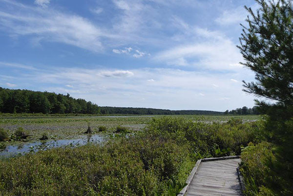
From the parking area at Mooring Area 3 in Black Moshannon State Park, begin your hike by finding the signs and blazes for Bog Trail. Follow Bog Trail for .3 miles and enjoy the boardwalk and informational kiosks. Keep a lookout for birds, beaver and water snakes.

After the boardwalk enter the forest and turn left at a signed junction. This is the official start of the Moss-Hanne Trail. Soon enough, Indian Trail will appear on the right. Indian Trail joins Moss-Hanne Trail for a bit before Moss-Hanne Trail turns left and crosses a boggy area on a narrow wooden bridge. Moss-Hanne winds around wet areas near the lake while weaving through pine plantations for the next few miles.

Soon the Moss-Hanne Trail reaches a junction with Blueberry Trail on the right. Moss-Hanne continues straight, through another bog, before intersecting with the other end of the Blueberry Trail, again on the right. Then Moss-Hanne Trail crosses Black Moshannon Creek on a long bridge, rises to the height of the land, and curves to the right before intersecting with Allegheny Front Trail. Allegheny Front Trail and Moss-Hanne Trail share a path for the rest of our route towards Beaver Road. Be sure to follow the signs for Moss-Hanne Trail, as there are a few intersections. From here to Beaver Road, Moss-Hanne crosses several wet areas. Keystone Trails Association volunteers and Black Moshannon State Park employees maintain hundreds of yards of bog bridges along this side of Moss-Hanne Trail.

The trail ends at Beaver Road. The safest way to reach a car at the parking area on Shirks Road is to cross Beaver Road and hike along the Allegheny Front Trail for a few hundred yards before turning right on Moss-Hanne Cutoff/Parking Area Trail. Follow this trail back to Beaver Road, cross the road carefully and arrive at the parking area.

Ready to cool off? Head on over to Black Moshannon Lake and enjoy a swim! Or head to the camp store and enjoy some ice cream!

You can make your own adventure by exploring the many side trails that connect with Moss-Hanne Trail. Grab your Moshannon-Quehanna Lizard Map and look for Blueberry Trail, Indian Trail, Seneca Trail, Hay Road Trail, Star Mill Trail, and Ski Slope Trail for various ways to make longer hiking loops with Moss-Hanne Trail.
