Your Cart is Empty


Reflections of a Trail Running Cartographer
Descending the cliffs into Shingletown Gap, Rothrock Trail Challenge (photo by Blake Cohen)
~ Special Guest Blog by Erin Greb
a Lizard Maps Contributing Cartographer
My idea of fun is running through the woods on a sweet singletrack trail. Most of the time, I’m alone, but a few times a year I love to participate in a long distance trail race with hundreds of other likeminded folks. It feels awesome to push your limits, take in the beauty of the forest, and of course the after-party with BBQ, beer, and good company isn’t too shabby!

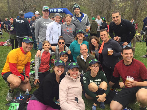
Scenes from before, during and after the Hyner View Trail Challenge
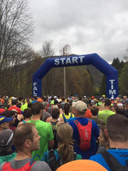
I just finished racing in the Hyner View Challenge and had a blast.
I am currently preparing for the Rothrock Trail Challenge 17.2 miler this June. For this fall, I’m debating between the Green Monster Trail Challenge or the Call of the Wilds 25k, and next spring I will run the Hyner View Trail Challenge for the third time. No surprise that as a cartographer, I tend to do lots of map research before a trail race in order to answer many questions:
- How many steep climbs/descents are there and what is the elevation gain?
- What are the chances that my feet are gonna get wet?
- Am I going to be on a ridge exposed to sun, or in cool valleys?
- How secluded will I be, or are there some forest roads?
- How many views are there?
Preparing for these races with a big picture understanding of an area can be a real plus! Purple Lizard Maps are at a perfect scale and level of detail for recreational use, making the maps super helpful for planning training runs and getting a feel for what you will face on race day.
Lucky for me, I not only have the full Purple Lizard map collection, but I work on the maps as a cartographer! So I am pretty familiar with the lay of the land before I run on the trails. I run regularly with a GPS, and afterwards compare my GPX file to the Purple Lizard map to see where I was in relation to the world around me.
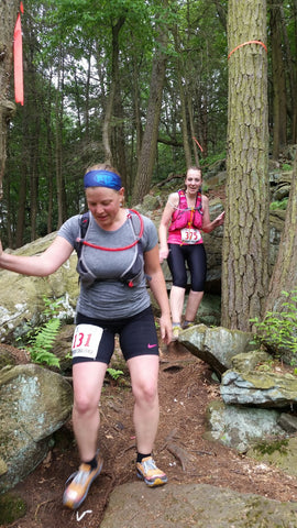
Descending the cliffs into Shingletown Gap, Rothrock Trail Challenge (photo by Blake Cohen)
I’ve been reviewing the Rothrock map for the upcoming Rothrock Trail Challenge. I know that map and Rothrock from the inside and out. I used the very first edition in the 90’s to hike with friends, and now I use the latest 6th edition for running races. As a Contributing Cartographer with Purple Lizard, I also know Rothrock through the work I do on my computer helping compile the latest edits to the trail system for each new edition.
Nevertheless, I always discover something new each time I open the map or head out to the trails in Rothrock. And the more I run the trails, the more information I gather to keep them up to date, helpful and interesting for others like me who are using the maps to plan adventures on the trails.
In preparation for the races I’m considering in October, I’ve been studying the Pine Creek Lizard Map. There is lots to discover in this special place and many fantastic trail races take place in this region.
The Green Monster Trail Challenge, in Tioga State Forest, is located just northwest of the town of Wellsboro, PA. From reading the map, I see that I can stay at the Bear Mountain Lodgeor Bear Meadows Lodge, and if I need any last minute supplies I can stop in at Wild Asaph Outfitters. Whether I choose the 15k, 25k or 50k (um, nope!), the trails used for the races are all on the map!
If I trace my finger 50 miles down the Pine Creek Rail Trail I can find Waterville, PA, home of the Call of the Wilds 25k. Starting in Little Pine State Park, the race explores the Tiadaghton State Forest, including the Torbert Trail, which I’ve heard is a pretty memorable climb. And by looking at the contour lines on the map, I can tell my legs will be burning when I reach the top!
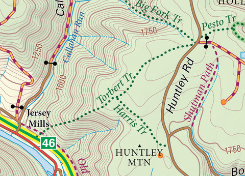
Torbert Trail, part of Call of the Wilds 25k,on the Pine Creek Lizard Map
It’s one thing to help create these maps on my computer, it’s another to then use them in the woods, and then bring my GPX files and knowledge back to the map to improve and enhance it for the next edition. Being a contributor to Purple Lizard Maps really is about adventure!
If you are looking to check out some trail races in really beautiful places, check these Central Pa races out.
Pine Creek Lizard Map:
Eagleton Mine Camp Trail Challenge
Bald Eagle Lizard Map
Rothrock Lizard Map:
Greenwood Furnace Trail Challenge
See you out there on the Trails!
*Erin Greb is a Purple Lizard Maps Contribution Cartographerand Owner of Erin Greb Cartography.