Your Cart is Empty

Meadow Run Trail: Big Rocks and Cool Falls In Ohiopyle State Park, PA

Meadow Run Trail is one of our favorite trails in Ohiopyle State Park. It has it all: woods, rocks and water, as it takes you to crazy big climbing rocks amidst giant rhododendrons, then to lots of access spots along Meadow Run where you'll find wading pools and waterfalls. Hiking, climbing, fishing, sightseeing and playing in the pools of Meadow Run are what you'll find along this short loop trail. It's an easy hike, by Ohiopyle standards, and it's cool and shady on those hot summer days. The trail is under 2 miles, but you'll be exploring a bunch of side paths along the way.

Use your Ohiopyle-Laurel Highlands Lizard Map to find the trailhead parking area south of downtown Ohiopyle on Dinnerbell Road. This loop hike is fun in either direction, but we prefer the counter-clockwise direction. From the trailhead, follow the trail to the right, which first leads slightly uphill, then skirts around the peak of a low hill. After walking around the hill, the trail leads you to the large boulders of the climbing area, and then descends to Meadow Run. The rocks along this section are impressive and include bolted anchors for top-rope climbing. Perhaps you'll get to see climbers doing their thing on these large outcrops.
This trail can get very muddy after rainfall, especially in the lower sections along the stream. If you choose to hike the section between Flat Rock and Natural Slides, you will have to be in the stream at moderately high water, and it won't be passable at truly high water. If the water is running high, it's best to visit natural slides from the parking area, and then drive to Meadow Run Parking Area to hike the upper section to Cascades and Flat Rock. We prefer to start at the top, at the Meadow Run Parking Area, and walk to the boulder section first, then downhill to see the cascades, explore along the stream to Flat Rock, and then hike back to the Meadow Run Lot.

The trail follows the contours of the low hill above the parking area as it winds towards the climbing rocks.
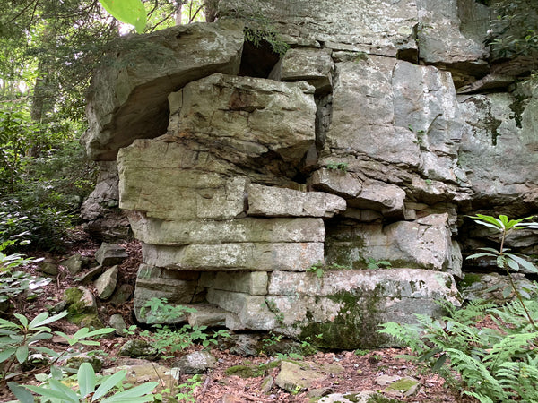
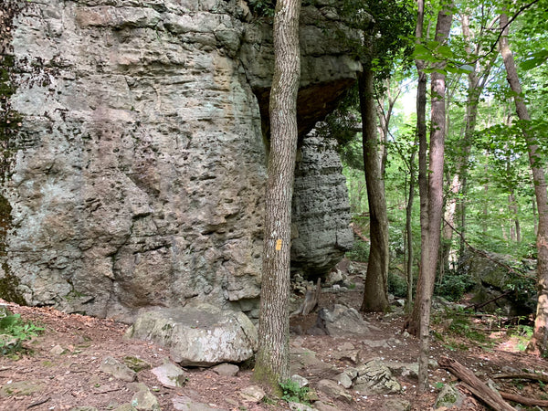
You'll see lots of interesting rock formations.
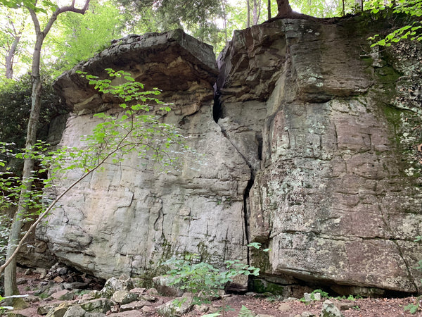
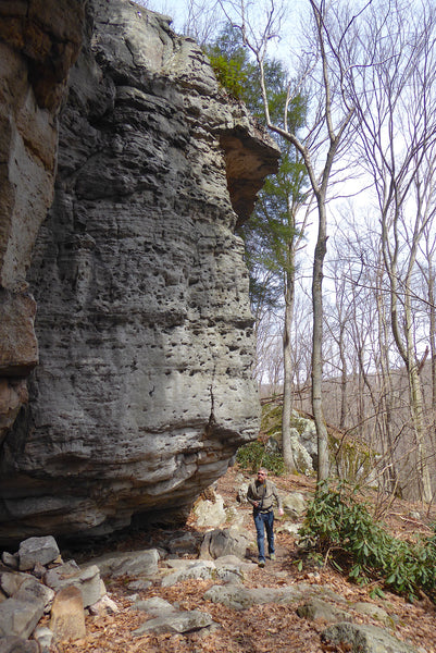
The Climbing Symbol found on Lizard Maps will lead you to outcrops like this! Hiking this trail in early spring or late fall will let you see all the boulders scattered about. In summer the foliage hides a lot of it.
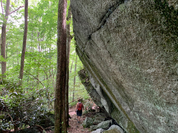
On hot summer days the rock walls are cool and comfortable places to meander.

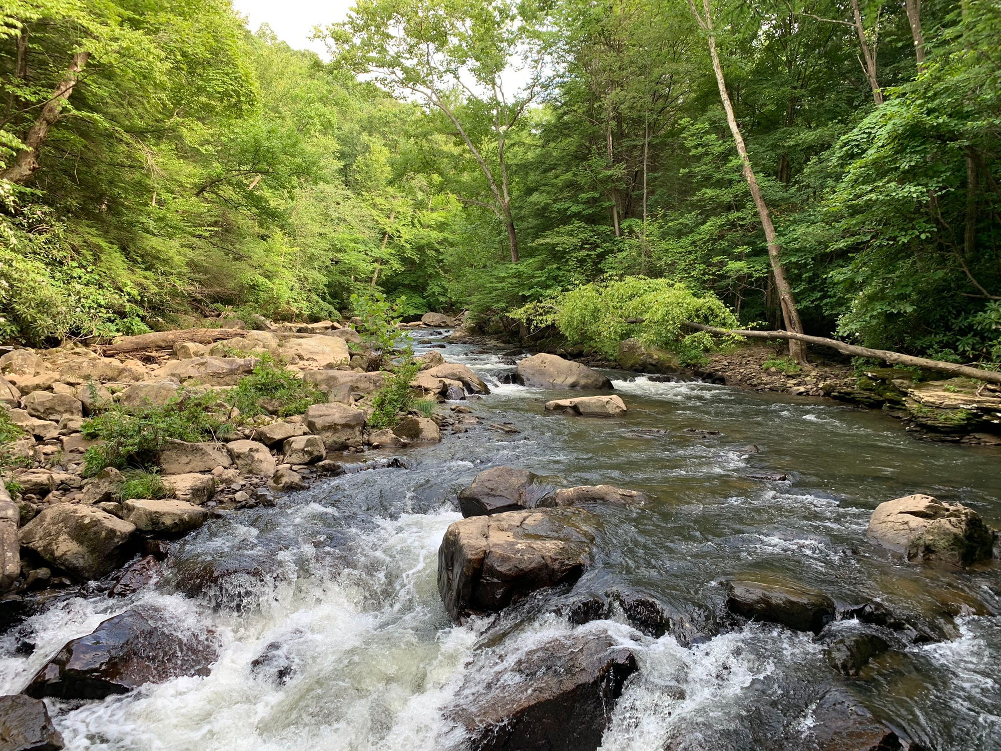
After the exploring the many boulders and rock walls, the trail leads hikers down to the cool waters of Meadow Run. The trail appears to split both upstream and downstream at Meadow Run, but the official trail heads downstream. A muddy logging era road leads upstream and loops back to a gate on Dinnerbell Road. Although this path is used by fisherpeople, you won't find it on the Ohiopyle-Laurel Highland Lizard Map because it is not an officially recognized trail corridor by the State Park. To follow Meadow Run Trail, you'll head downstream to view your first Lizard Spot, known as Cascades, which is shown below. The waterfalls are really beautiful to see, listen to and sit by. Or sit in, depending on the temperature and your preferences!
The cascades on a hot summer day.
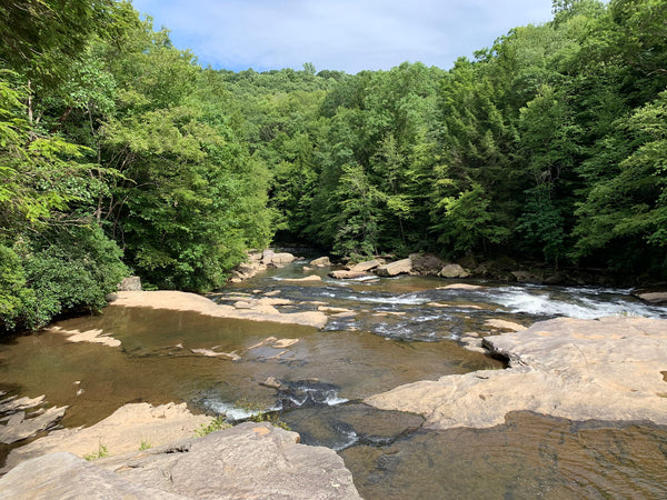
The view from above the Cascades looking downriver.
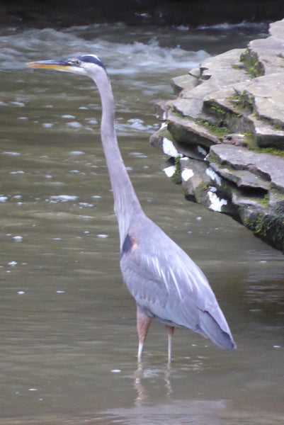
There is also plenty of wildlife to find along Meadow Run. Early morning and early evening is the best time to spot wildlife in the area. You'll find interesting plants throughout this hike.


Continue to follow the trail as it leads downstream. You'll find lots of side trails leading to great views of Meadow Run, each with their own special character.
 The trail winds along Meadow Run and offers many opportunities to access the water.
One of those side trails leads to Flat Rock, which is the second Lizard Spot on this hike. Flat Rock is a special place for hikers to take a break and cool off in the water, especially on a hot summer day. When the water is high it has a 'natural slides' section that you can float down. Hikers can turn left after Flat Rock and follow a wide, well-used path gently uphill back to the parking area, or continue straight on a trail that continues downstream along the cascading waterway.
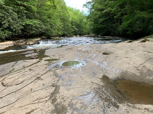
As the name implies, Flat Rock is a massive piece of exposed stone that the water flows through, around and over. It's a really amazing place, and well deserving of the Lizard!
Just after Flat Rock, be sure to take notice of the side trail off to the left. This side trail climbs gently uphill to the Meadow Run parking area, which most hikers will take back to the parking lot to complete this loop. If you continue downstream along Meadow Run, you'll end up at a wonderful lizard spot known as Natural Slides. You can also drive to this spot, or walk there from the Visitor Center, but it is all part of Meadow Run Trail.

The upper section of Natural Slides.
Natural Slides is an extremely popular area during the summer months - you will notice people riding these natural rock slides, as if they were theme park waterslides, on hot summer days. While this is allowed by the State Park, the rock slides are part of a natural waterway, so there is a real chance of getting scraped and bruised on the way down. There are no lifeguards in this area, so take proper precautions for yourself and your fellow swimmers. Follow the trail downstream from Natural Slides and enjoy the last sets of cascades and pools before Meadow Run spills into Youghiogheny River.

The lower section of Natural Slides spills into a series of deep pools.
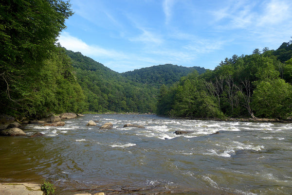
Meadow Run meets the Youghiogheny River.

The hiking path follows the stream under the highway, and if the water is high you'll have to wade out in the stream to follow it. The trail continues along the Youghiogheny River for a bit until it reaches the area below Cucumber Falls. At this point it stops being called Meadow Run Trail. Above Cucumber Falls it continues as Great Gorge Trail all the way to High Bridge, which is also wonderful and filled with multiple Lizard Spots along Youghiogheny River. But of course you know this already because you have your Ohiopyle-Laurel Highlands Lizard Map, right?

Cucumber Falls is the end (or beginning) of Meadow Run Trail.
Explore Ohiopyle State Park This Summer!