

Caught In The Hook: Pennsylvania's Largest Natural Area
Jan 06, 2024
Pennsylvania Natural Areas
What exactly is a designated Natural Area? The goal is to allow nature to take its course as it would without human interruption. Rather than being managed by humans, the State allows these lands to mature and regenerate naturally. To support this goal only exploring on foot is permitted: there is no camping, campfires, bicycles or horses allowed in a designated Natural Area. All motorized vehicles are restricted to the borders and roads around the area. Only day hikers can explore within the borders. The Hook Natural Area, found on our Bald Eagle Lizard Map, is PA's largest Natural Area and offers many opportunities for a great adventure.
The Hook
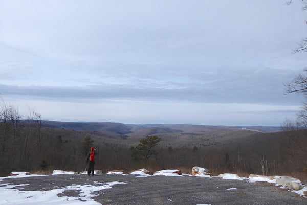
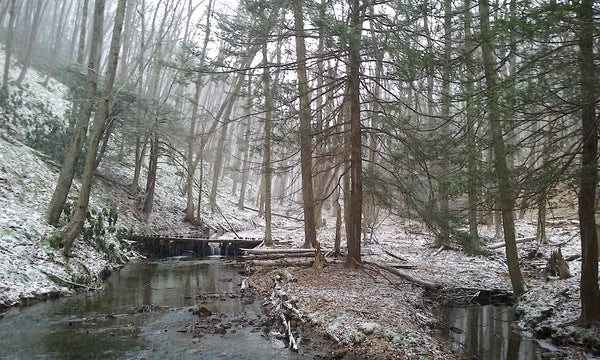
Coming in at a whopping 5,119 acres, this chunk of land, locally referred to as "The Hook", is located about 20 miles west of Lewisburg, PA. The area is completely within Bald Eagle State Forest and is mapped on the Bald Eagle Lizard Map. The Hook encompasses everything in the photo above (and more), which creates an entire watershed within this forest. This watershed is dissected by Panther Run and North Branch of Buffalo Creek, which fill the Mifflinburg Reservoir and provides water for residents in the surrounding region.
The Hook received its name from the visually stunning hook-like feature of the streams as they wind through the watershed. The area is recognized as an Important Bird Area by the National Audubon Society. Highlights include huge old growth trees such as White Pine, Hemlock, and Oak, thick stands of Rhododendron and Mountain Laurel, and a small (but increasing) presence of Green Briar and invasive Barberry.
History
Pennsylvania is filled with interesting and varied land-use history. Many portions of Central and Western PA were given to private landowners as payments or rewards for accolades during the Revolutionary War. A lot of these lands were then acquired by logging companies and other industries, which extracted and destroyed most of the natural resources. Pennsylvania purchased the "used" land after the logging era to revitalize the natural resource and manage it for natural resource extraction and public recreation (among other uses). Roughly 100 years later, we now have large sections of rejuvenated forests to explore.
Recreation In The Hook
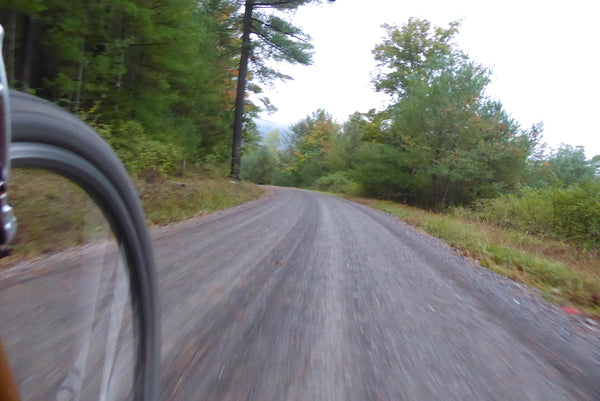
Gravel Roads
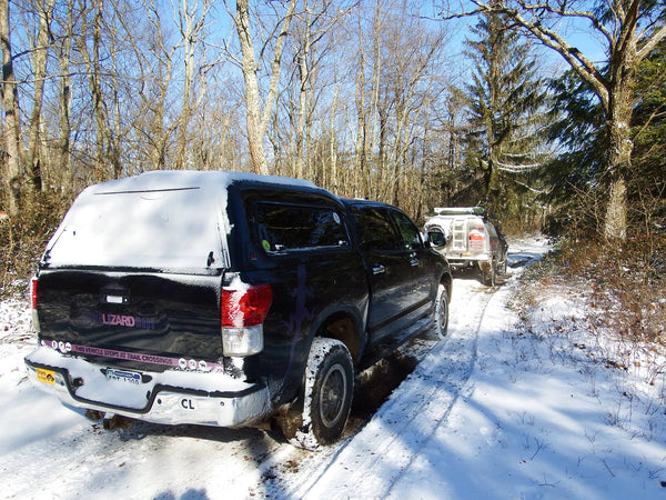
What does one do in The Hook? Step one: Grab your Bald Eagle Lizard Map and locate the Hook Natural Area just south of RB Winter State Park on Route 192. You'll notice several hiking-only trails dissect the natural area. These are rugged at best and most folks may find these trails too rough for enjoyment (see "hiking" section below). Luckily, a few forest roads surround the area and provide great fun for bicyclists and forest capable motor vehicles. Several vistas and pull-off spots exist for those who want to see the area from their cars. Cyclists and others can also use parking areas on Old Shingle Road near Frederick Trail and the Mifflinburg Reservoir.
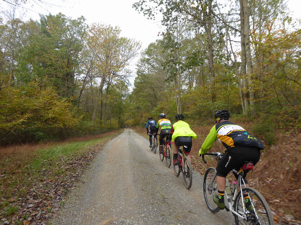
Motorists and fit cyclists may want to consider this loop route from Route 192 just south of R.B. Winter State Park: Climb Pine Creek Road and follow it westbound as it parallels the northern boundary of the Natural Area. Turn left (southbound) onto Stony Run Road, then hang a right towards Winkleblech Mountain. Stop at the Lizard Spot and then backtrack to Stony Run Road and head east toward Buffalo Flat Road. Buffalo Flat Road leads up to Old Shingle Road. Now complete your loop of The Hook Natural Area by making left-hand turns at Brandon Road and Jones Mountain Road. A second great option is to reference the 54-mile route of the 2018 UnPAved Pennsylvania Adventure Ride.
Plenty of gravel and dirt roads and drivable trails exist throughout Bald Eagle State Forest. We suggest referencing some of our overlanding blogs to get an idea of route options and road conditions. As with every endeavor, we suggest contacting the local state forester for current road conditions before heading out on an adventure. Learn about overloading opportunities in Bald Eagle Forest here:
Exploring the Northern Frontier of Bald Eagle State Forest
Exploring the Hidden Center of Bald Eagle State Forest
Exploring the Southern Frontier of Bald Eagle State Forest
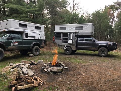
Car Camping
Two DCNR car camping sites exist near The Hook Natural Area. These sites offer a drive-in camping spot not far from a gravel road, with a picnic table and fire ring. Camping permits must be acquired from Bald Eagle State Forest beforehand. R. B. Winter State Park is only a few miles from this area and also provides seasonal camping opportunities.
Hiking
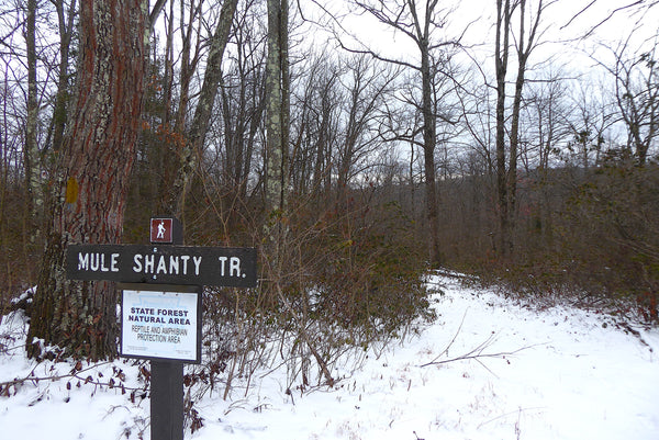
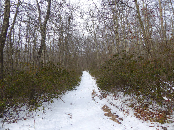
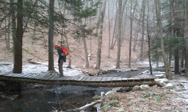
The only way to access the heart of this natural area is with your own two feet. While some trails may look like the image above, many trails in this area look like this (take note of the footbridge across the stream):
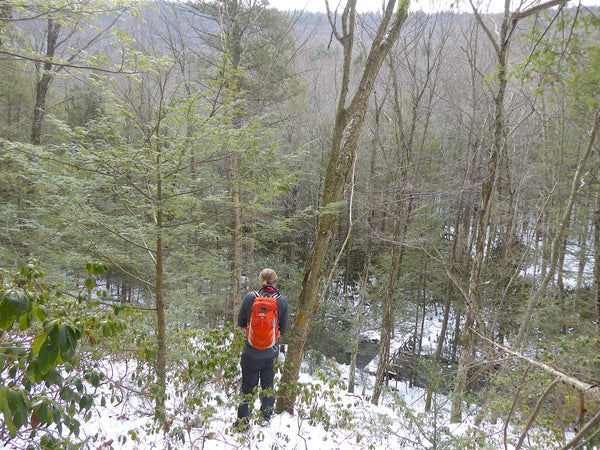
Most blogs posted online tell tales of lost, tired hikers vowing never to return to this wild, unmanaged area. We can confirm you will find rugged trails that are often overgrown and difficult to follow. This is part of the character of a Natural Area, and it attracts more experienced hikers.
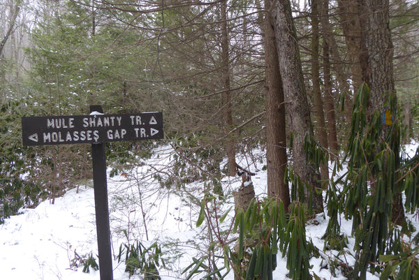
Those looking for especially challenging loops may consider descending Buffalo Path to Knoll Ridge Trail, then following Hook Tram Trail to Molasses Gap Trail back uphill to Jones Mountain Road. Finish the day with a roadwalk back to Buffalo Path.
Another difficult option ('challenging' may be another way to describe it - we think it's fun, but it sure isn't easy) is to park on Old Shingle Road near Frederick Trail. Descend Molasses Gap Trail, climb Mule Shanty Trail, hang a left and roadwalk for a bit, then turn left onto Frederick Trail to drop back into the Natural Area. Climb and crawl your way out along Frederick Trail back to your vehicle.
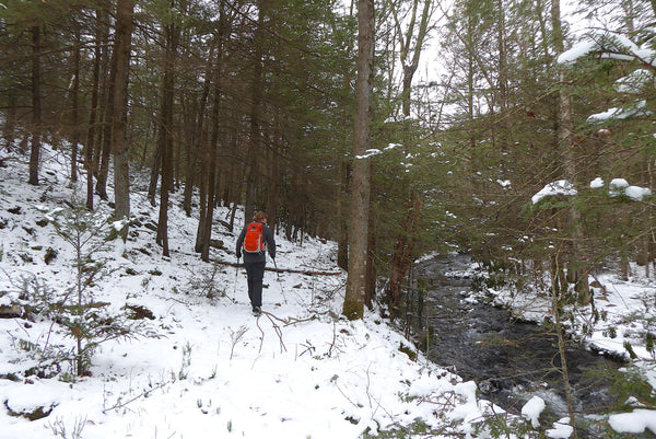
A more realistic hiking option for most folks is to park near Mifflinburg Reservoir and hike upstream on Hook Tram Trail. This trail is flat and parallels picturesque North Branch Buffalo Creek. The trail is quite rocky, so it is still somewhat difficult even though it doesn't include much elevation change. Hikers can explore far into The Hook before turning around and re-tracing steps back to the reservoir.
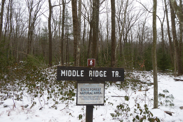
Lastly, consider a shorter hiking loop beginning on Jones Mountain Road. Mule Shanty Trail, Molasses Gap Trail, and Middle Ridge Trail all descend from the road. Follow one of these trails downhill into The Hook, explore the area for awhile, then follow another one of these trails back uphill to Jones Mountain Road.
The Hook is a rare gem hiding within a 90-minute drive from Harrisburg and a 45-minute drive from Williamsport and State College. When you visit come prepared for a wild adventure, and be sure to leave nothing behind but footprints.
Explore the Hook with the Bald Eagle Lizard Map


