

Golden Eagle Trail Plus: Your guide to "PA's Best Day Hike" & some fantastic alternate routes!
Feb 26, 2019
The challenging Golden Eagle Trail is often referred to as the best day hike in PA. With almost 10 miles of tough hiking, this trail is awesome any time of year. Alternative routes listed on this blog allow for even more rugged loop hikes totaling more than 15 miles of hiking. Highlights include beautiful vistas, sparkling mountain streams, ridgeline hiking, and tough climbs and descents in Wolf Run Wild Area and State Game Lands 68. Golden Eagle Trail is easily accessed from route 414, just a few miles south of Slate Run; use your Pine Creek Lizard Map to find trailhead parking and access areas.
The Golden Eagle adventure starts at the main trailhead lot alongside Bonnell Run. Begin your hike by carefully crossing the rail trail and route 414, follow the dirt path behind the Golden Eagle Trail sign, and hike upstream above Bonnell Run. Reach a trail register and sign in for safety purposes, then stay right at the intersection up ahead, and immediately begin a mile long climb to gain the ridge. A quick break on the edge of an old pasture followed by a few steep switchbacks help to make the 800ft+ climb bearable. Of course, the view at the top, which is also your first of six Lizard Spots on this hike, is pretty outstanding. This vista looks over the next few miles of the Golden Eagle Trail as is ascends Wolf Run. The Wolf Run Bald Vista clearing at the top of Bob Webber Trail is visible across the Wolf Run valley.

The trail leads downhill on a narrow, rocky ridge towards the famous Ravens Horn rock outcrop. Get your cameras ready for this vista! This spot is the most popular attraction along the route for both hikers and animals, including a few rattlesnakes that reside here. Remember that you are visiting these snakes’ home, so be polite and watch where you step, climb, sit, etc...

Great Views In Every Season

Golden Eagle Trail immediately descends down the rocky ridge below Ravens Horn. A very steep descent with multiple switchbacks reaches Wolf Run after descending over 800ft in less than one mile. The trail to the right leads a short distance to the rail trail (check out your Lizard Map for a shortcut back to your car). The Golden Eagle Trail turns left, upstream along Wolf Run. Multiple cascades and unique rock formations surround this area. The trail crosses the stream multiple times, but wet feet are worth it for the reward of hiking in this beautiful area.

The trail follows Wolf Run upstream for more than a mile to reach a split in the waterway. To the right lies Watson Fork and Wolf Rock overlook (another Lizard Spot), which is a short off-trail scramble that is generally worth a good view when the leaves are down for the fall/winter. The Golden Eagle Trail stays to the left and walks under a cool canopy of large hemlock trees and white pine trees. This is actually the site of an old logging camp, and parts of an old stove remain alongside the trail. The climbing gets tougher, but the top is a short distance away. After a nice vista looking back down Wolf Run to Ravens Horn, the trail leads to a gated dirt road. The Golden Eagle Trail travels through State Game Lands 68 for the next several miles. Beulah Land Vista, with a bench, lies ahead on the right. This spectacular vista just happens to be near the halfway point of this hike. At 2,180ft, it's also the highest point of the hike. Needless to say, it’s a great spot to take a break.

The Golden Eagle Trail is generally downhill from here. Be sure to pay attention to the blazes to stay on the correct trail. Go left at a fork in the road and quickly reach Bonnell Run Vista, which is another amazing spot along this route.

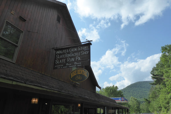
Continue downhill on the road another short ways when the Golden Eagle turns left at a saddle in the ridge and descends steeply into Bonnell Run. Now simply follow Bonnell Run downstream, crossing the stream several times for a few miles until the end of the loop. Stay right at the loop intersection (unless you feel like hiking the loop again!). Find the trail register, sign out, and head back to your car! It is highly suggested that all hikers drive north to Wolfe’s General Store for a bite to eat, and/or some ice cream as a way to end this wonderful dayhike!
Alternative Routes: for hikers who want to add some extra rugged miles to this loop. The trails listed below may be very overgrown and unused during summer months. Create you own adventure, and bring your Lizard Map!
Note above when the road splits between Beulah Land Vista and Bonnell Run Vista; roughly five and one half miles into the loop described above. Instead of following the Golden Eagle Trail to the left towards Bonnell Run Vista, you can take the dirt road to the right for over one mile, until a side road/trail splits to the left. Stay left to hike a very narrow ridge on a trail called Hilborn Trail. The trail descends slightly into a saddle, than climbs back out. There are multiple vistas along this ridge, but the trail itself is difficult to follow. Reference your Lizard Map for assistance.

After reaching the top of the mountain at 2,050ft, the trail turns to the left and begins an extremely steep descent. This descent follows the ridgeline over 1,200ft downhill in less than one mile and runs out directly on the rail trail, past mile marker 34.

If you’ve had enough, now is the time to follow the rail trail roughly 4.5 miles downstream to your car. This would be a loop of about thirteen miles total. Lucky for you, Wolfe’s General Store with drinks, sandwiches, ice cream, and more is along this route.
If you haven’t had enough scrambling and still want more, turn left on the rail trail and immediately turn left again after crossing Hilborn Run. Now attempt to follow Hilborn Run Trail back up to the Golden Eagle Trail. Even experienced hikers have difficulty following this trail as it climbs over 1,000ft in about one mile back up to a dirt road. If you can’t find the trail from the rail trail consider these directions: follow the water upstream to a fork, follow the fork to the right (south), follow this watercourse to the top of the hill where you should reach the Golden Eagle Trail on a dirt road. When you reach the dirt road, Golden Eagle Trail should be on the other side. Here you can complete the rest of the Golden Eagle Trail (14 mile loop total), or turn right for more rugged hiking, and explore a very lightly used hiking trail called Dragon’s Back Trail.

Dragon’s Back Trail explores a narrow ridgeline high above, yet very near Pine Creek. This ridge boasts multiple views for roughly two miles. The ridge then becomes private land, so hikers must utilize several switchbacks to descend off the mountain on Quarry Mountain Trail to reach the rail trail and Tomb Flats Access Area. From here you can cool down with a one and one half mile walk back downstream along the rail trail to your vehicle at the Golden Eagle Trailhead. This alternate loop is roughly 14 miles total.

Enjoy the journey!


