

Exploring the Dolly Sods-Seneca Rocks Lizard Map: The Northern Tier
Oct 11, 2024
There are a lot of dirt roads in Monongahela National Forest that are worth exploring. For that matter, many of the paved roads are also unique driving experiences. Camping options abound at the National Forest campgrounds or the Dispersed Camping Areas, as well as the simple fact that you are allowed to pull over and camp at many other spots within the forest. There are some rules on this – you can’t do that everywhere – but we’ll tell you about some of our favorite routes on the northern side of this Lizard Map.
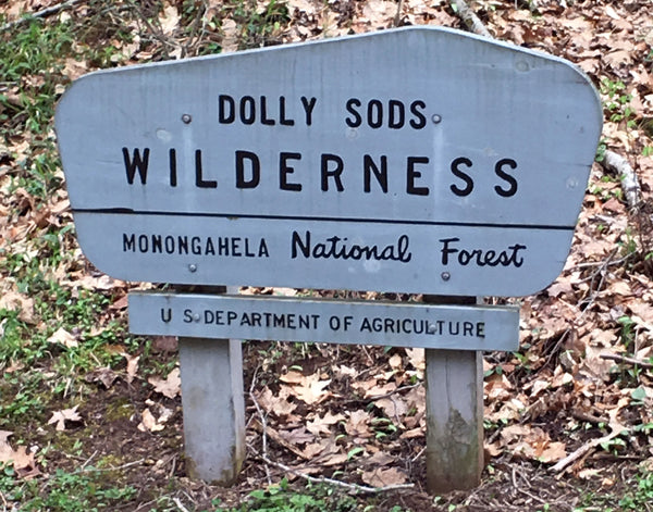
Our favorite approach to Dolly Sods Wilderness is from the east using Forest Road 75. We like this road so much we made a Lizard sticker for it. Depending on your approach, you'll enter from Route 48, and be sure to top off your tank long before you get near the Sods. Find your way to 28/7, also called Jordan Run Road. Route signs in WV are like fractions - you'll get used to it. Take 28/7 until you see the sign for Dolly Sods and FR75.
Dual Sport riders will also appreciate these routes. Depending on the season, the water levels may be a bit high for some riders on motorcycles, so we'll leave that decision up to you. As for the overlanders, there is nothing to be concerned about, these are not snorkel routes. The geology of this region tends to have stone bottoms, so there aren't many mud holes to worry about, and traction is rarely a serious concern. In all of our travels mapping the Mon, which was over 1,000 miles, we hardly ever needed 4wd in our Toyota Tundra CrewMax. In fact, we never needed 4wd - but we do use it to minimize risk and minimize any unnecessary environmental damage to the roadbed. With few exceptions, our other recon vehicle, a Toyota RAV4, could navigate most of it. But I wouldn't want to try our luck on some the high clearance roads in the RAV4, although clean passage with some rock stacking here and there is entirely possible, so is ripping off parts of the undercarriage, exhaust and transmission...
Dual Sport riders don't have that magic 4wd button or as much low hanging fruit to contend with, and newer bikes offer some amazing traction control settings. It will be a combination of rider skill and tire choice that makes or breaks your day in the Mon. Our field work days riding the KLR650 with TCK80s, we never gave it any thought. That set up will do fine in any conditions. On our Africa Twin with stock tires, which we consider to be road tires regardless of the 90/10 or 80/20 suggestions by the manufacturer, we would need to be a little more cautious - but the traction control on that bike is amazing and it does its thing flawlessly.
Here's little known fact: even if you start from the western side, from Blackwater Falls State Park, Davis or Thomas, the drive time is the same to Bear Rocks! Make a loop of it by heading east on Route 48 to 93 at Mt. Storm Lake. Route 93 is a really neat series of twisty turns with a view as you drop off the ridge to Route 42, which heads south to meet 28/7 and FR75. It is the type of road motorcyclists dream of. If you are in the area on two wheels, seek out this section of road. It isn't on the Lizard Map, it's just an inch or so off the NE edge, but you can find it easily.
FR75 quickly turns to dirt, which in itself is a celebratory moment for us, and climbs up switchback after switchback for about 4.5 miles and 2,100 feet to reach the summit and main parking area at Bear Rocks Preserve on the northern edge of the Dolly Sods Wilderness. For many people, this is the end of their journey – final destination. They get out of their car, walk over to Bear Rocks, take some selfies, look around, and call it good. For others it’s just the beginning, as the backpacks come out and the cars are left behind for a few days of solitude walking through this amazing landscape.
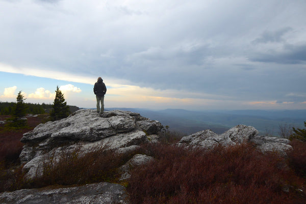
Exploring the outcrops at Bear Rocks. It's a pretty cool picture, but we suggest you use google image: bear rocks dolly sods. Bam! Is that amazing or what?
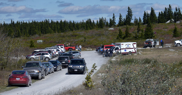
The parking area at Bear Rocks gets incredibly overcrowded. This is empty by Sods standards. The paramedics are part of an active Search and Rescue mission for a lost hiker, which is also incredibly common. We were there when he was found, safe and sound. Bring your Lizard Map!
You can’t overnight in your vehicle or pitch a tent at this upper lot so this is a place to budget some time to hike around and enjoy being on top of the world, which is exactly what it feels like. The downside to this area is on some days it feels as if the entire world has arrived to be on top of the world, and sometimes you may find school buses and tour buses and motor homes and this is not the wilderness experience you were after. The good news is even with an overfilled lot, within minutes of hiking into the Sods you quickly leave all that busyness behind, and although you will run into other hikers on occasion this is a big place, and you can find plenty of solitude here.
The Sods is a very, very big place without a single road in the wilderness.
If you are car camping, or moto camping, and want to stay nearby, one option is to backtrack down FR75 and look for the sites on the side of the road. These are legal to set up camp in, but be sure to be aware of what is a public site and what may be private. Private land is usually well posted. Another option is to find a site at the Red Creek Primitive Campground on the high plateau. This is one of our favorite places to base out of. It is small – only 12 sites – and kind of close quarters although several sites do offer some privacy. It is seasonal - open roughly April thru December. If you are into taking long day hikes this is a fantastic base camp to operate from. It has water (sometimes) and toilets and nothing else. It’s at least an hour or more round trip to get any supplies, so arrive prepared. The sites are all first-come-first-serve so there is no guarantee, and on a weekend you’ll need special powers if you think you can just roll in on Friday night at 7pm and find a site. However, on some weekends, our special powers have come through for us, so don’t rule it out. Mid-week your chances are much better. The one downside to Red Creek Campground is exposure. When storms roll through, which they often do, you are going to experience the full force of the storm, so be ready for that. The winds are severe, the rain is severe, it can snow and hail almost any day of the year, and it will be a total test of your campsite preparation skills. Or it may be a lovely clear night with a gentle breeze and star filled sky as you gaze into the Milky Way and ponder what it means to be a human being spinning on this planet in the universe. We sincerely hope you get the latter experience, although the former makes for better stories when you get home.
 Bob Dylan sang "Cause I can't see which way the wind blows". But you'll certainly be able to feel which way it blows when you're on the top of the Sods!
If you have a backpacking kit you can hike in to any number of camping spots off of FS75 and make camp. Many amazing sites do exist – they are unmarked, so you’ll need to tap into your sixth sense of adventure to find them. Trust us, they are out there and worth finding. We did not put any of them on the map because we believe some knowledge has to be earned. The only rules are you have to be camped more than 300 feet from the road and leave no trace. This last request, as simple and self explanatory as it sounds, is often violated in obscene ways in Dolly Sods. People hack down live trees thinking they will burn, scatter trash in their campsites, and leave with old fires smoldering. People, we need to self-police this area, and if you see this behavior in action please get involved and speak up! Personal safety issues are important, but most of this behavior is newbies in the woods who are ignorant of best practices. If you have the room and energy, please pack out the trash others leave behind.
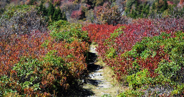
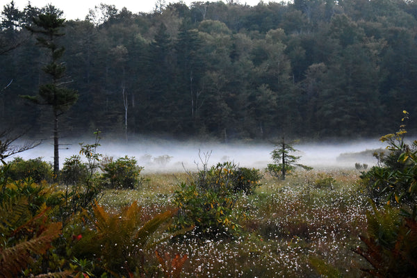
Sundew Trail is always worth a wander.
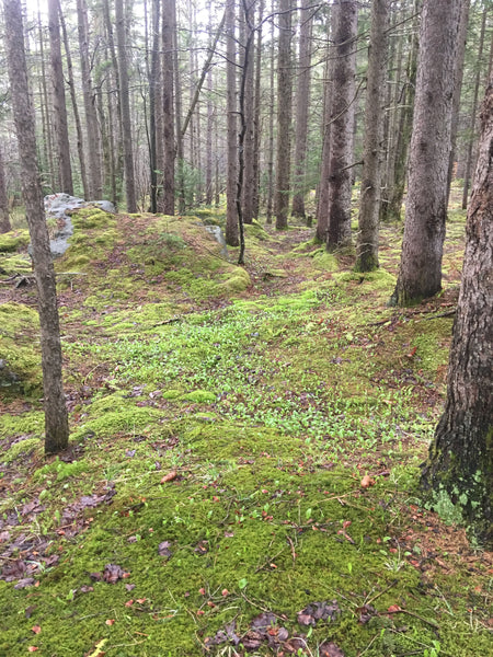
One of a zillion amazing backcountry campsites await hikers in Dolly Sods.
After some exploring the ridge, it’s time to drive south on FR75, also known as The Road to the Sky. The name makes perfect sense as you drive across the plateau, if you’re lucky enough to be in a convertible or topless Jeep you can reach up and touch it.
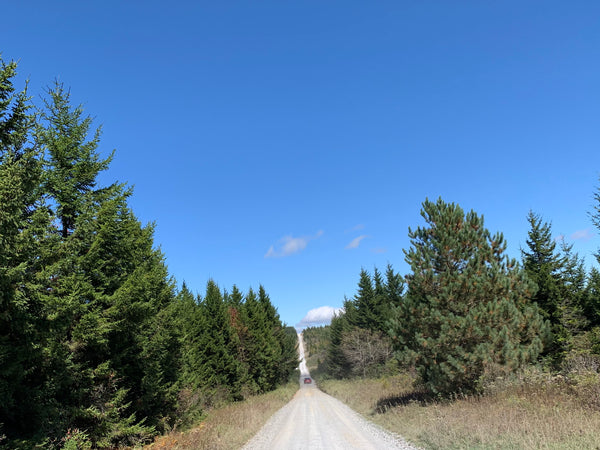
The Road Across The Sky.
Take a few minutes to stop at the Lizard spot on the eastern side of FR75 before you reach FR19. The short walk out is well worth it!
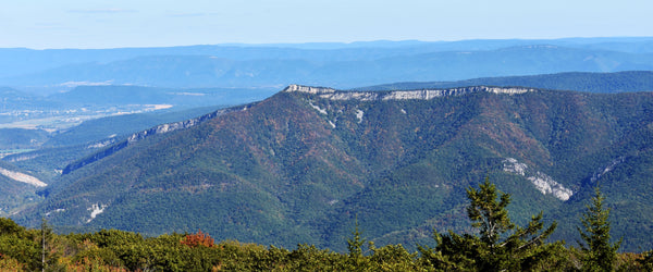
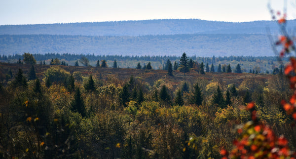
You want a vista? We got a vista! This is a lizard spot looking east from the Road Across The Sky, FR75. The North Fork Mountain Trail (hiking and mountain biking) dances on the top of that escarpment, another great adventure to put on your bucket list.
Now you begin the descent off the mountain and drop down to the Canaan Valley along Route 32. This is such a beautiful drive, and you'll enjoy the smooth pavement for a while.
Now you have a choice - and it depends on two things, your vehicle and how you feel about that vehicle. If you have a 4wd with some ground clearance, and you don't mind pinstripes, we'll show you the back way in to Lindy Point and Blackwater Falls State Park. If you don't know what we mean by pinstripes, this may not be a good idea. But you do not have to take this rough route, you can stay on pavement to Davis, head to Backwater Falls State park, and out to Lindy Point. It will take pretty much exactly the same time!
If you don't mind this look, take the back way in.
Head north towards Davis, but don’t actually go to Davis yet. Take the Canaan Loop Road on the left. This Forest Service Road starts off as a smooth dirt road, and you will find dispersed campsites to consider taking for the night. You can’t reserve these, so if you want one, you need to claim it. Hang a tarp, set up some chairs, leave some stuff to claim your space if you plan on returning.
The scenery along Canaan Loop Road is pretty sweet.
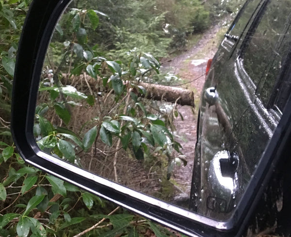
After about 10 miles the road will make an obvious change to non-maintained 4wd. At this point you are on private land, so you cannot make camp on this section, but you can drive through to Lindy Point, which is on State Park land. The few miles of rough section in between attracts overlanders, dual sport riders and bicyclists who savor the rocky stream crossings, endless puddles and sense of remoteness. We never needed to engage 4wd on our Tundra CrewMax but the Slee sliders carry some scars from poor line choice, and many pinstripes were added to the sides from rhodedendron branches. Carrying a chainsaw is a good idea, we have encountered downed trees that were recently cut and would have forced a long reverse gear retreat if they were solid.
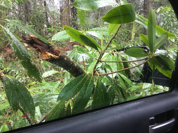
Attack of the Angry Rhododendrons!
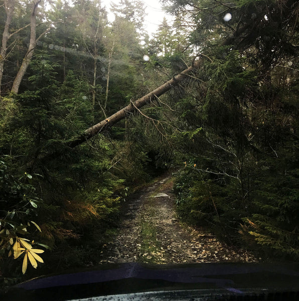
The road is tight. If that tree was actually down we would have needed a chainsaw to continue, and backing up would have been miserable.
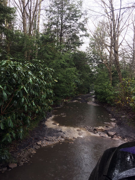
When it's wet, it's very wet. The bottom is sandy but firm.
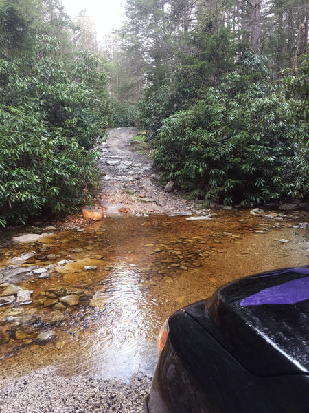
You'll find a few stream crossings. This is low water - beware of high water conditions. Your rhododendron pinstripe factory awaits.
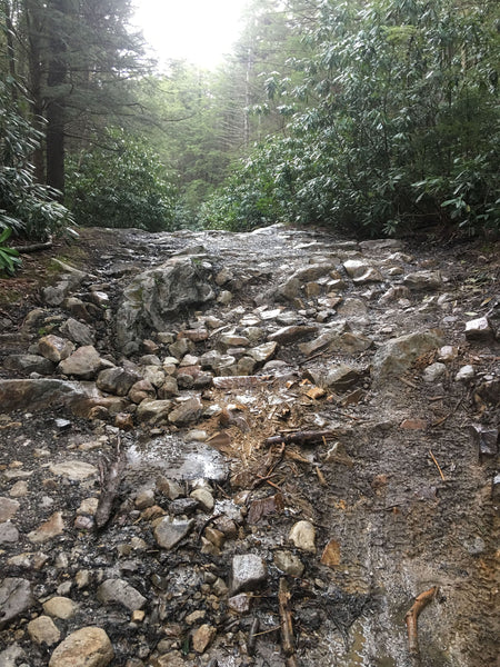
The rock that had a short love affair with our Slee slider is pretty obvious. Too bad it wasn't so obvious while we were in motion. Sometimes driving the big Tundra gets us complacent about line choice, and this one woke us up. Thank you Christo! You saved us an expensive rocker panel repair or worse.
Objects in Mirror May Bite. Line choice remains a concern for the length of the Tundra CrewMax... and by the way - thanks to whoever sawed this one off before us but why didn't you take another 18 inches off?
When the road becomes paved you are at the Lindy Point trailhead. Formal parking is for about 4 vehicles, but you can find places to pull off along the road. Lindy Point is well worth the short walk out, especially at sunset. The hike is a little under a mile round trip. It is one of our favorite Lizard spots!
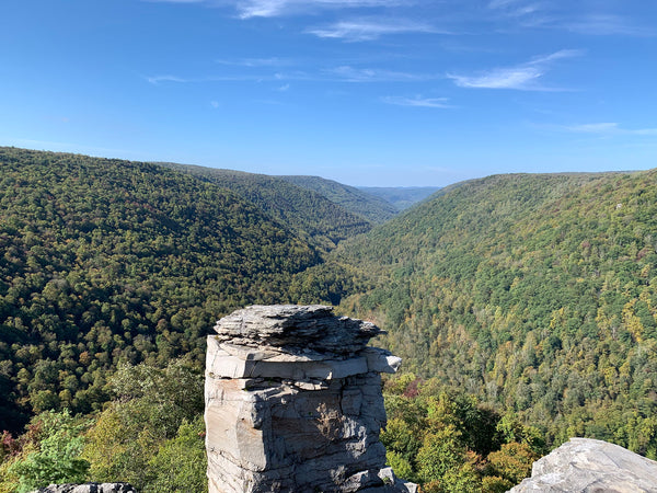
The view at Lindy Point is always worth it!
After Lindy Point the road gets better, eventually reaching pavement into Blackwater Falls State Park. Stop at the upper waterfall viewing platform on the left to find the easiest view of Blackwater falls. The image below shows the lower observation deck (those are people wearing red) which is also a fun walk, it's a seemingly endless series of staircases and boardwalks to get to the lower deck. Lots of great hikes, overlooks and camping to be found in Blackwater Falls SP, this is an excellent choice for basecamp.
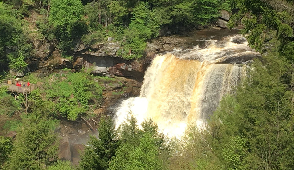
The view of the falls from the upper observation deck is the easiest way - only about a one-minute walk from the road on a flat, paved path.
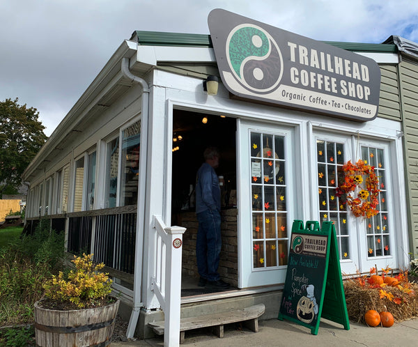
But we’re still in motion on this roadtrip – so head out of the park on Blackwater Falls Road and turn right on Route 32 to find the town of Davis, West Virginia. If you’ve never been to Davis this place is a pleasant surprise. It’s kinda like a western mountain town, with a business district about two blocks long with a few watering holes, some artsy gift shops, a great bike shop, some unique eateries and one supermarket. Everything you need, and not much more. Modern civility prevails at Trailhead Coffee, where you can get a great cup of joe or a triple non-dairy mocha latte to supercharge your system.
If you're looking for trails or fishing spots, take a drive down Camp 70 Road, which you’ll find behind the supermarket. Most of these are popular mountain bike routes, and there are some hiking-only loops at the end of the road. Camp 70 Road follows the river and has many spots to access the Blackwater River for boating or fishing. At the end you’ll find a formal boat launch. Although much of this is National Forest Land you cannot stay overnight anywhere on Camp 70 Road, this section is all day-use only. Mountain bikers should stop in at Blackwater Bikes, which is a legendary local bike shop now in a brand new location. Next door you'll find Highland Market, which is a great place to get some eats and grocery supplies to top off your camping kit. If you’re looking for rooms for the night check out The Billy Motel, the best little roadside motel and bar within 100 miles and hands-down our personal favorite. Many a night of mapmaking recon was capped off at this bar and motel, which served as our remote office and sleeping HQ for many moons when we were making this map. Another great spot is the Bright Morning Inn, which has the absolute best breakfast in town. But if you’re overlanding, and you have your motel room with you, keep on truckin’ towards Thomas, the sister town of Davis, just a few miles up the road.
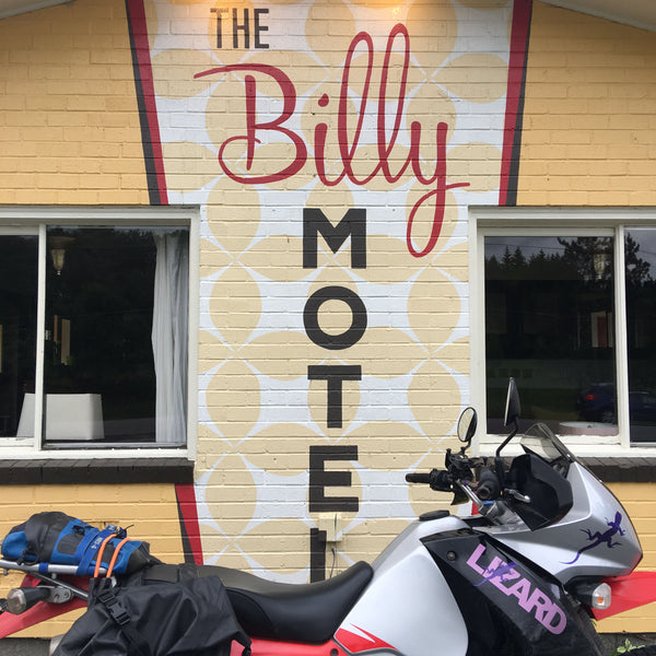
We can't wait to return to the Billy!
You can do a hot lap through Thomas, it only takes a minute! But our driving adventure starts on Douglas Road, off Route 32 just a few hundred yards before Thomas proper. Turn left on Douglas Road after Mountain State Brewing and before you hit the tiny metropolis of Thomas. Be sure to stop in at Mountain State Brewing one of these evenings, but for now stay on Douglas Road until it turns to dirt. Now you are on Forest Road 18 and climbing into Monongahela NF. Within a hundred yards you just left all traces of civilization behind and it could be 1855, except your horses are all under your hood and working magnificently to carry you along this old bench cut road.
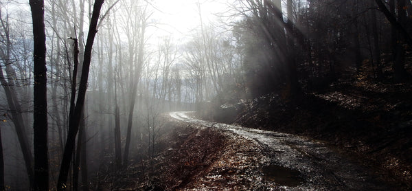
FR18 on a foggy spring morning. This is one of our favorite routes!
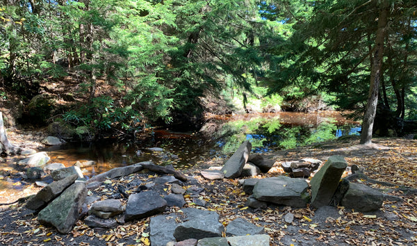
Enjoy the water crossings and make sure you find the Lizard on this one – you won’t be disappointed. If you are looking for a place to take a break and have a picnic, this would be the spot. You can also set up your rig and overnight along FR18 at several places.
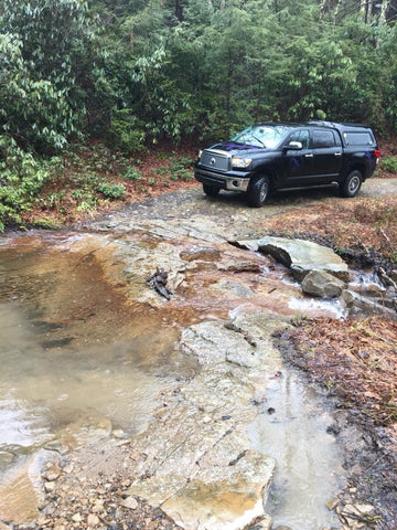
There are several water crossings on FR18. The base is usually solid but you should always get out and check conditions.
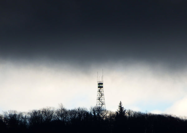
Take FR18 to FR717 and turn left to find the Olsen Fire Tower. If you are not afraid of heights this is worth the climb up for a fantastic view of the mountains to the west – you are now looking at the town of Parsons, and across the landscape mapped on our Elkins-Otter Creek Lizard Map. We’ll save that for another day – after Olsen head north to route 219, and turn right (east) towards Thomas.
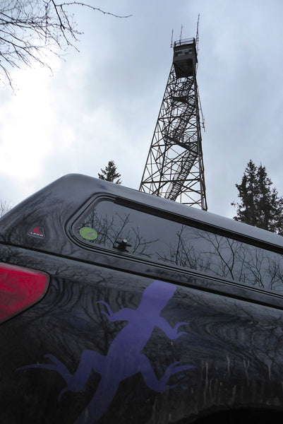
Olsen Tower is not for those afraid of heights.
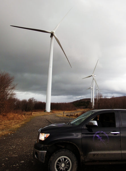
Along Route 219 are two lizard spots on your left – the first is Long Memorial Park which has a great view and is worth stopping at. The second is found soon after, and it is simply the wind farm on the ridge. If you’ve never stood under a wind turbine this is your chance. They are really ginourmous in person and the heavy woosh-woosh-woosh sound is pretty neat.
From here, if you drop down the winding road from the windmills, you will end up off the Dolly Sods-Seneca Rocks Lizard Map and on the Elkins-Otter Creek Map. Todays adventure will stay on the Dolly Sods Map, so return to Route 219 and continue to Thomas. You won’t be able to avoid cruising the strip that is downtown Thomas because the highway splits to one-way and you have no other choice. Lucky for you this downtown is simply amazing, and you should probably stop and enjoy it for a spell. Similar to Davis, but different, with much taller buildings and only on one side of the road as the railroad used to dominate the other side. Today that is a rail trail and waterfront park.
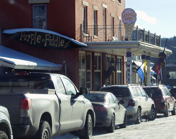
Thomas is filled with art galleries and well curated antique stores. You'll find great coffee, sweets and eats at Tip Top Coffee, which morphs into a bar at night. The Purple Fiddle is our kindred spirit in all things purple and you’ll find great eats and most likely some live music, as they have gigs booked about 320 days of the year. The Cooper House is the best Bed and Cocktail we've ever found.
That completes your tour from the Road to the Sky to Lindy Point to Blackwater Falls to Olsen Tower with stops in both Davis and Thomas. It can be a very long day or a three day adventure - your call on how many miles you want to cover. There are so many places to get sidetracked for a few minutes or a few hours that we suggest you consider this a long weekend, or a long week! It offers a couple of fun loops to drive and shows you a lot of hiking and biking trail opportunities along the way. If you’re not going set up camp and skottle-feed your crew you can enjoy any number of eateries in Thomas and Davis, and return to your campsite. Or just hole up at The Billy or Bright Morning Inn and soak in some creature comforts. We won't tell a soul.

