

Purple Lizard's Pine Creek Rail Trail Ice Cream Tour
Aug 17, 2023
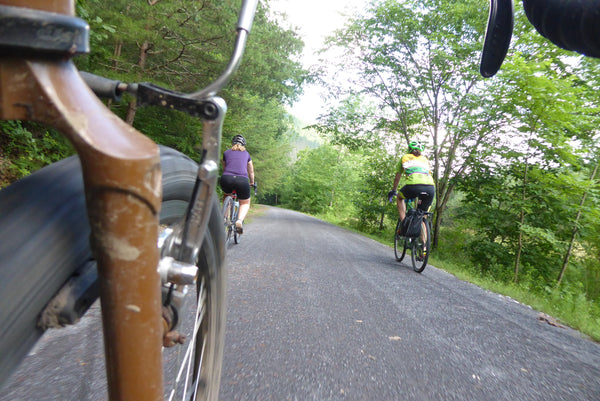
People of all ages love to walk, run and pedal the Pine Creek Rail Trail.
Purple Lizard is always looking for a new twist on adventuring, and we found the perfect blend of summer fun - ice cream and rail trails. There is a lot of ice cream available on the Pine Creek Rail Trail (PCRT), but how many of us have experienced all of the ice cream on the PCRT? Our Trail Guru and a couple friends have, and they are more than happy to share the gravel regarding the PCRT.
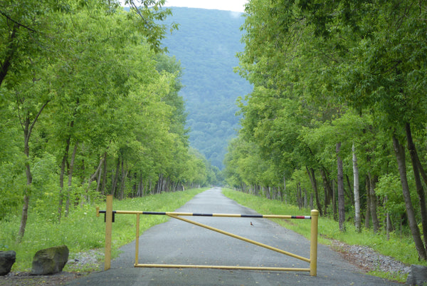
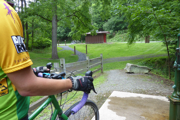
The PCRT begins just north of Wellsboro and drops southbound over 62 miles downstream at an average 2% grade to Jersey Shore. Hikers, bikers, and horseback riders (allowed in a small section in PA Grand Canyon) can experience wildlife, cool flowing streams, side trails, interpretive signs, food and drink, and of course a few lizard spots from our Pine Creek Lizard Map. Since this is a linear trail, explorers will either need to complete and 'out and back' journey or set up a shuttle system. Luckily, Pine Creek Outfitters will shuttle folks anywhere between Wellsboro and Jersey Shore. They can also get you a Pine Creek Lizard Map to make the most of your adventure. We decided to leave a car at Mile 0.0 and have Pine Creek Outfitters drive it to Jersey Shore for us. Our first stop was a farmers market at mile 0.0, where we enjoyed some ice cream to begin our adventure. This is the perfect start to any big adventure - a big ice cream cone for brunch!
The beginning of the trail leads along Marsh Creek, which boasts green herons, great blue herons, and other fish-eating birds feasting in the marshy landscape. The fish and frogs probably aren't nearly as excited as we are to see these large, beautiful birds along the shore. The trail also leads riders over a rather fun, and rare, arch bridge. To learn more about the history of the Pine Creek Rail Trail, check out Linda Stager's book, The Pine Creek Rail Trail Guidebook.
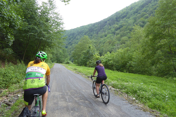
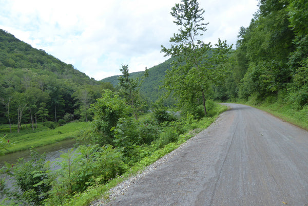
There is parking and bathroom facilities near mile 4 and mile 8, but we passed these and continued on to the PA Grand Canyon section of trail. This section offers a spectacular remote feeling while still being on a smooth gravel surface. Highlights include a narrow steep canyon with towering cliffs above and rapids beside the trail. If you've ever visited the amazing overlooks high up on the ridges at Leonard Harrison or Colton Point State Parks, you would have looked down into the gorge and seen this section of rail trail. It's one of the best sections of the PCRT to pedal.
After a few miles of remote riding we took a quick break at Turkey Path Trail to check out the waterfalls, which are noted in another blog regarding the PA Grand Canyon. On this day, we chatted with a few other adventurers, then hopped back on our saddles and headed towards the Tiadaghton Access Area to check out the parking, primitive camping, bathrooms, and (untreated) water area at trail mile 16.
Now we were merely 9 miles from our next ice cream stop. The canyon walls were steep all around us, but we still enjoyed a relatively flat ride along the water of Pine Creek.
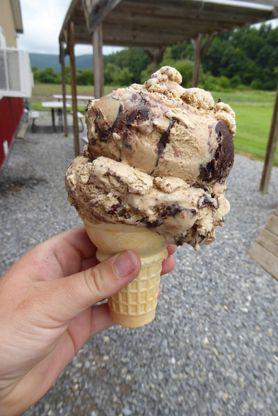
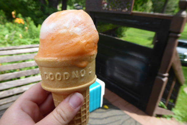
Finally we reached Miller's Store at Blackwell. Everyone enjoyed the second ice cream cone of the day.
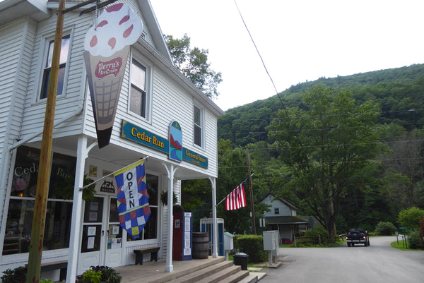
A fun, bumpy railroad bridge crosses Pine Creek south of Blackwell. Shortly after this lies Hoffman Campground, which is a great spot for weekend adventures to spend the night (DCNR permit required: reservations can be made on-line). Day users wanting to explore the PA Grand Canyon can go one mile further to Rattlesnake Rock Access. Still other advenuturers will prefer to go a few miles further and stay at Pettecoat Junction in Cedar Run. We, on the other hand, thought it would be a good idea to head four miles down the trail to the Cedar Run General Store and grab some more ice cream! In a surprising last minute decision, Emily opted out of the ice cream challenge so she could ride the rest of the day without feeling ill. Dave and Drew couldn't understand what she was talking about and continued on powered by even more ice cream! Both Pettecoat Junction and the Cedar Run General Store carry the Pine Creek Lizard Map just in case you forgot yours.
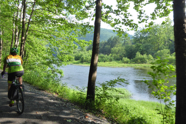
The six mile stretch between Cedar Run and Slate Run follows the creek fairly closely. We took our time here to let our ice cream digest as we surpassed the halfway point of our trip. Maybe Emily had a point after all.
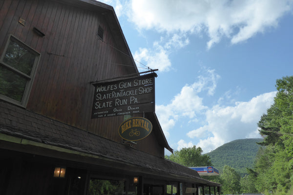
All too soon we reached Wolfe's General Store in Slate Run, and Dave ate some more ice cream. Drew was now out of the competition, but curiously stuck with his plan of a 'lactose overdose' by eating a block of cheese. Emily was smart and ate a famous sandwich from the Wolfe's deli. The sandwiches at Wolfe's General Store are amazing and definitely something you should plan your ride around. You can also pick up the Pine Creek Lizard Map at Wolfe's if you don't have one yet, or your friends are getting tired of your constant requests to look at theirs.
Our journey continued after a nice long break in Slate Run to let the recent, and rather constant, accumulation of caloric intake sink in. We headed south and crossed Tomb Flats Access Area, which included parking and permit only, primitive camping. This sparked an idea to bike this rail trail in a 2-3 day weekend while camping, and eating more ice cream, along the way. There sure are enough places to park cars, to camp, and to eat; plus, cyclists wouldn't need to carry many supplies!
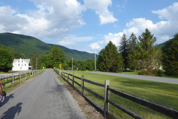
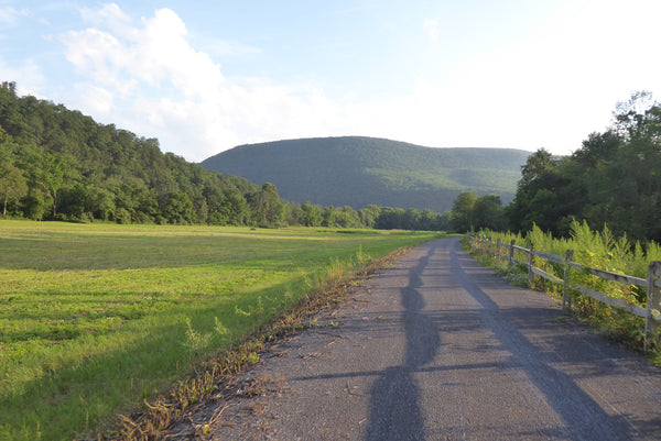
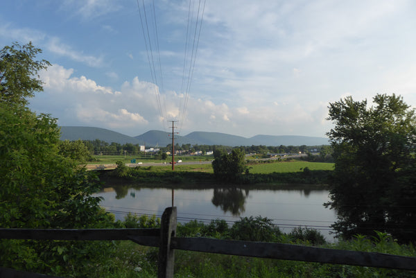
The valley widens as the rail trail heads south and there are many mountain views to enjoy while riding near the creek. We also passed several hiking trailheads with parking access, and a few more bathroom facilities as well.
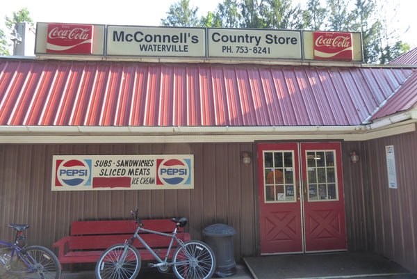
McConnell's Country Store, near mile 51 in Waterville, was our last scheduled stop for this trip. Dave successfully downed ice cream cone number five, while Drew and Emily looked on in a state of gastro-disbelief. We sat beside other cyclists and visitors who were also enjoying the rail trail on this fine sunny afternoon, and wondered how much ice cream they were considering. Probably not 5 cones, but Dave is a seasoned professional. McConnell's Country Store also has a deli with sandwich options for those who can run on more than Dave's hi-test blend of dairy and sugar. You can also pick up the Pine Creek Lizard Map at McConnell's.
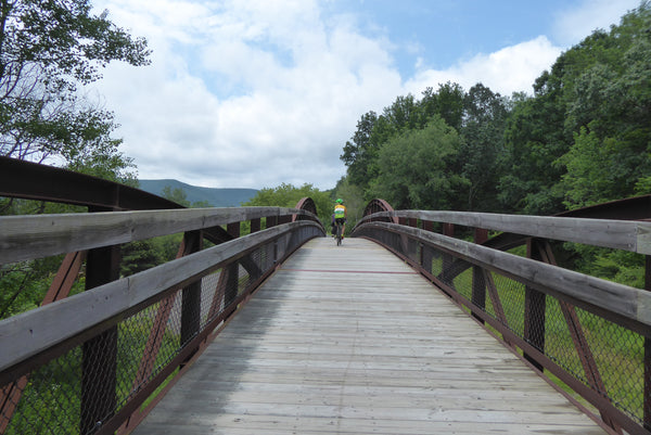
We crossed another fun bridge over Little Pine Creek, and then crossed the more famous Ramsey Bridge over Pine Creek a few miles later. Both bridges offer a glimpse of the rail history and great views of the creek. These old railroad bridges make delightful bike paths, and we enjoyed the views from both.

The rail trail leads through open, sunny fields for about 8 miles along the southern terminus. the evening sun lit up the hillsides while we enjoyed riding in cool shadows for most of this section. The open meadow views, with deer and wildflowers everywhere, were spectacular.
The rail trail crosses Pine Creek one final time on Torbert Bridge, then reaches Torbert Access Area with parking and restroom facilities. Shortly thereafter, the trail leads up and away from Pine Creek.
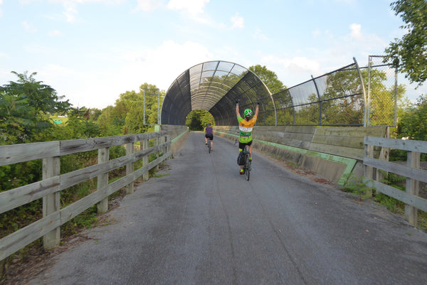
Soon enough the trail crosses route 220 over a modern pedestrian/cyclist bridge. The trail turns to pavement on the south side of this bridge and ends a mile later. We made it to our car, (big thanks to Pine Creek Outfitters for the shuttle), stretched our sore muscles, loaded up our gear, and headed home; happy to have enjoyed a very full day riding the entire length of the Pine Creek Rail Trail. We all like to measure our adventures differently, and on this one our Trail Guru covered 62 miles in five ice cream cones!
The adventure was so much fun, that our Trail Guru went back again for another go-round of ice cream and cycling overindulgence. Read about that trip here: Purple Lizard Pine Creek Ice Cream Tour

Purple Lizard Maps is an independent map company that makes beautiful maps of beautiful places. The Purple Lizard Team and their friends can usually be found adventuring on one of the many existing Lizard Maps or doing recon on whatever maps they are working on next. Grab a Lizard Map and make your own adventure!


