Your Cart is Empty
Rincon Puerto Rico: Lizard Map, Surf & Beach Guide - The Most Comprehensive Guide to Rincón PR
$18.00
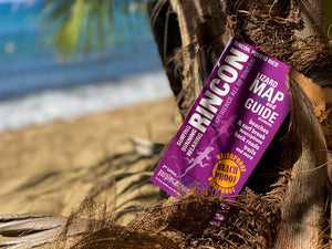
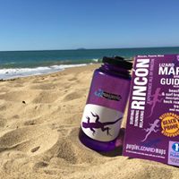
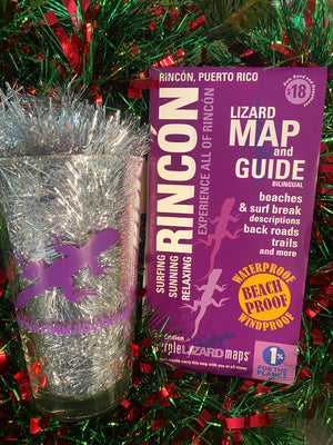
The Rincón Lizard Map & Guide is the most detailed and trusted surf, beach, and adventure map of Rincón, Puerto Rico. Freshly updated and designed with local knowledge and award-winning cartography, it helps surfers, beach lovers, and travelers explore confidently — from famous breaks to hidden beaches, mountain backroads, and unforgettable sunsets.
Bilingual map and guide: English on one side, Spanish on the other.
The Rincon Lizard Map & Guide is your key to uncovering all that Rincon has to offer.
This Map and Guide is Perfect for
-
Surfers planning sessions at Rincón’s best breaks
-
Beach lovers searching for calm coves, long walks, or sunsets
-
Snorkelers and divers looking for access points and conditions
-
Travelers who want to explore beyond resort roads
-
Planners and adventurers who want the big picture and great cultural context, not just pins on a phone
Get the most comprehensive and detailed map and vacation guide for your visit to Rincon Puerto Rico.
Why Bring a Map to Rincón?
Rincón is full of hidden beaches, unmarked access points, and winding backroads where cell service can be unreliable. A printed map lets you see the whole place at once — how beaches, surf breaks, roads, and terrain connect — so you can explore freely, adjust plans, and discover spots you might otherwise miss.
Featuring detailed descriptions of Rincón’s surf breaks and beaches so you can plan the perfect island adventures.
The Rincón Lizard Map & Guide is your key to uncovering all that Rincón has to offer. It identifies beaches, surf breaks, trails, and a wide range of cultural and other points of interest across this Caribbean jewel of a town — helping you explore with confidence and context.
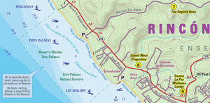
This beautifully designed, easy-to-read topographic map features contour lines, elevation data for both land and sea, shaded relief, and all the key details you need to plan your adventures: backroads in the mountains, parking access, public lands, historic sites, and more.
As with all Purple Lizard Maps, it’s durable and waterproof, designed for real-world use. The map opens to 24” x 36”to give you the big picture, and folds easily to 4” x 8” to fit in a beach bag or daypack.
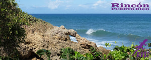
Rincón’s beaches and surf breaks are world renowned and extraordinarily beautiful, but they aren't all easy to find!
A global destination for surfing, paddle boarding, scuba diving, and snorkeling, Rincón is also a popular place to learn from some of the best instructors around. Adventurers, sun worshippers, beach sitters, and vacationers alike come here to explore and often return again and again.
Surf Breaks and Beaches:
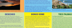
Detailed surf break descriptions by longtime Rincón surfer and local Melissa Taylor of Puntas Surf Supplieshelp you better understand what you’re about to paddle out to. The map identifies 15 different surf breaks and 17 distinct beaches, each with its own personality — from powerful reef breaks to calm, sandy stretches perfect for wandering barefoot.
All the ins and outs:
The Lizard Map & Guide also helps you understand where you may want to stay, as Rincón’s many neighborhoods and surrounding areas each offer a different visitor experience.
With the Rincón Lizard Map, you’ll be exploring like a local in no time.
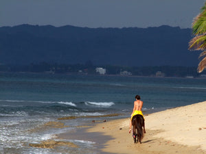
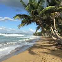
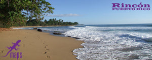
You’ll find trails to beaches hidden among rock outcrops and historic retaining walls, beaches shaded by almond trees, beaches with big waves and steep banks, and long expanses of flat shoreline with gentle, shallow water ideal for wading and exploring.
Walk the southern beaches along the Caribbean Sea, then compare them to the northern beaches facing the Atlantic Ocean, all within a compact, beautifully mapped area.
Towns: Rincón, Aguada, and Añasco
Lizards:
As with all award-winning Purple Lizard Maps, the small purple lizards scattered across the map mark interesting places worth checking out — a mystery waiting to be uncovered. The legend reads:
“This could mean anything: cool place, sweet view, local legend.”
Which basically means: we spotted some very cool places to make your vacation extra special.
Note: We believe in real world mapping: We have spent almost two decades visiting this extraordinarily beautiful corner of the world every year, and we developed this guide in close consultation with local longtime local residents - so you really can count on the content.
The Rincón Lizard Map scale is 1:17,200 (1 inch = 0.27 mile) and includes both latitude/longitude and UTM coordinate systems.
Looking for a romantic island getaway, a fun-filled escape with friends or family, or a quiet beach and beautiful sunsets to unwind on your own? Rincón is for you.
On the Lizard Blog
Looking for a romantic island getaway, a fun filled and beautiful island escape with friends or family, or just want to find a quiet beach and beautiful sunsets to unwind by yourself? Rincon is for you.
Rincón Puerto Rico - Caribbean Romance Awaits
Logistics
Rincón is a great destination for last-minute plans and spontaneous getaways.
You don’t need a passport, remember, Puerto Rico is a U.S. territory. Rincón is easily accessible from most major airports, especially along the Northeast Corridor.
Fly into Aguadilla (BQN) (about 40 minutes from Rincón), or into San Juan (SJU) and drive across the island (about 2.5 hours). You can also take a short Cape Air flight into Mayagüez (about 30 minutes from Rincón).
To explore all that Rincón offers, renting a car is strongly recommended.
Learn more about Purple Lizard and the making of the Rincón Lizard Map & Guide in El Coquí, Rincón’s monthly tourism magazine.
To learn more about Rincón, follow Purple Lizard’s Rincón Facebook page @PurpleLizardMapsRincon and check out El Coquí Magazine.
All Purple Lizard Maps are available flat (unfolded) and are suitable for framing in a corporate lobby or hanging in a home, cabin, or surf shop. The map price is the same ($18); shipping varies. Email info@purplelizard.comfor details.
To learn more about Rincon, follow Purple Lizard's Rincon Facebook Page @PurpleLizardMapsRincon & check out El Coqui Magazine
Do you run a business in Puerto Rico and want this best in class map and guide for your customers? Email us and we can get you set up as an authorized Purple Lizard Maps Dealer! info (at)purplelizard (dot) com
All Purple Lizard maps are available flat (rolled up, unfolded) suitable for framing in a corporate lobby or just nailing to a cabin wall. The map cost is the same ($18) but shipping varies. E-mail info@purplelizard.com for specifics.
Want the best of both worlds?
Get the Map and the Digital Version on Avenza
The Avenza App Version of Rincon Map & Surf Break Guide

The Avenza App version of the Rincón Map & Surf Break Guide lets you see your live GPS location on the same detailed map and guide content as the printed version. It works offline, requires no data or roaming, and is compatible with iOS and Android.
However, we still recommend the real thing.
For the best experience, pair the digital map with the printed map for all the rich detail, next level durability, exceptional planning, changing plans, envisioning, inspiring and, of course, the big picture!
Shipping Privacy and Return Policies
We are a proud member of 1% For The Planet.
Health warning: continued use of Purple Lizard maps may result in an inability to stay indoors and a sudden criticism of traffic and the desire to escape to a beautiful tropical town on the tip of Puerto Rico. Your skin may become covered with sand. Mild confusion will make it difficult to relate time and distance, which may alter your definition of weather. There is a potential for all of these side effects to occur simultaneously and without warning. That's why we are warning you now.
Product Type : Maps


